
The final 3.88 km of the Phan Thiet – Ke Ga coastal road just got cleared
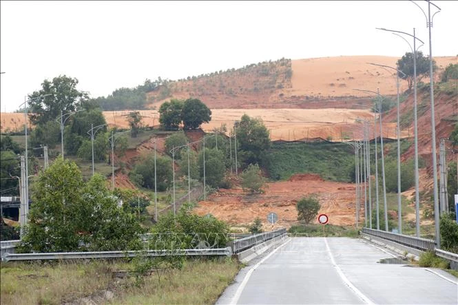
On July 27, Vietnam's Ministry of Agriculture and Environment approved closing 12.5 hectares of the Nam Suoi Nhum titanium mine, handing the land over to Lam Dong province. For anyone working in tourism along this stretch of coast, that's news about a route about to get shorter.
Why 3.88 km matters more than the 17.8 km already done
For any road project, completed volume and actual usability are two different things. A route that's mostly built but still broken in the middle still can't be used — vehicles still have to detour back onto the old road.
Before this section opens, the 17.8 km already paved is just a dead-end spur: starting at National Highway 1A and stopping at the Suoi Nhum bridge. Once it connects through, it becomes a continuous coastal corridor from Phan Thiet all the way to Ke Ga. Same amount of asphalt, completely different usefulness.
The July 27 report states roughly 17.8 km already built and about 3.88 km blocked by the mine — adding up to 21.68 km, while the full route runs 25.61 km. That leaves about 3.93 km whose status the report doesn't describe. We're keeping the report's own figures rather than filling in that gap ourselves.
The bottleneck was about authority, not money
The missing land wasn't in the hands of local households — it sat inside the titanium mining area held by Tan Quang Cuong Trading Co., Ltd. That's what made this different from an ordinary land-clearance case.
For land held by residents, the province has the authority to survey, price, and compensate — a long process, but entirely within local hands. For an active mining concession, reclaiming the land first requires closing that part of the mine, a procedure that falls under ministry-level authority. No matter how fast the province wanted to move, it had to wait on that.
What just happened is exactly that step: the Ministry approved closing 12.5 hectares at the Nam Suoi Nhum mine, handing it over to the Lam Dong provincial government for construction. Provincial leadership has asked for the remaining land handover to be finalized within July 2026, aiming to complete the entire route within 2026.
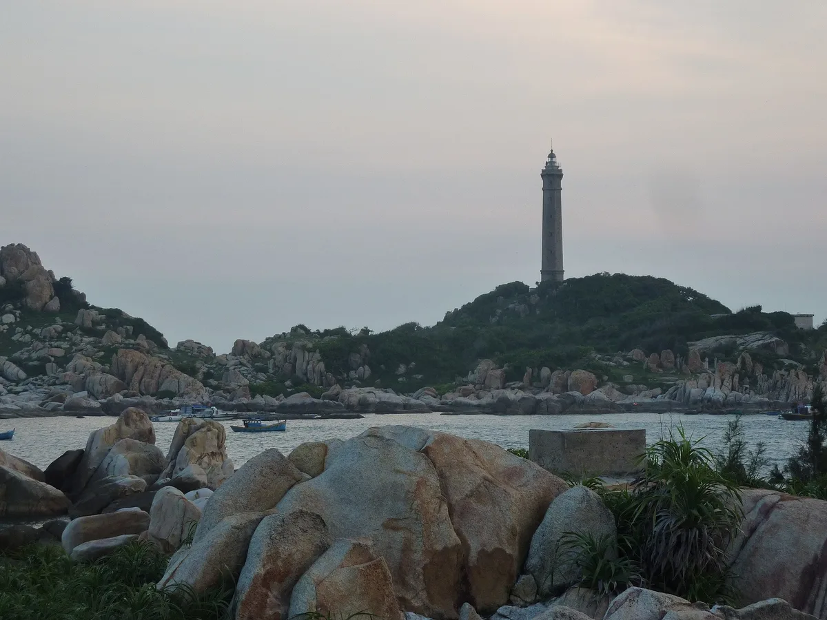
What this route changes for a day trip
This is the part that matters most for guests staying at NovaWorld and along the Tien Thanh coast. Ke Ga has long been the farthest point on the usual itinerary, and also the trip most often cut from the schedule — not because it's not worth seeing, but because it ends up eating a whole half-day.
A shorter trip to Ke Ga is less of an expedition
With a continuous coastal corridor, the drive out to the lighthouse runs straight along the shore instead of looping back onto the old route. A half-day trip has a real chance of becoming a couple-hour outing.
Tien Thanh – Ke Ga becomes one connected loop
Tien Thanh beach, the fishing village, and Ke Ga cape all sit on the same route. Covering the whole loop in one morning becomes realistic once the road connects through.
A backup plan for rough-sea days
On days when the waves are too high for an island trip, there's still the coastal drive to fall back on. A good road means a real contingency plan.
To be precise: the route wasn't yet connected through at the time of this report. What just happened is the land-handover procedure — construction on the remaining 3.88 km still needs time. Anyone planning this year's itinerary should still plan around the existing DT.719 route, and treat the new one as something to look forward to, not yet something to rely on.
Placing DT.719B in the bigger picture
This route doesn't stand alone. It's one layer in a cluster of infrastructure simultaneously changing how people access the coast south of Phan Thiet.
| Infrastructure | Role | Status |
|---|---|---|
| Dau Giay – Phan Thiet expressway | Brings visitors to the region — cuts travel time from Ho Chi Minh City to about 2–2.5 hours | Operational |
| DT.719B Phan Thiet – Ke Ga | Moves visitors along the coast once they've arrived | ~70% of volume done, land just cleared |
| Existing DT.719 coastal route | Currently carrying all traffic out to Ke Ga | In use |
| Tourism projects along the route | Give people a reason to travel the whole loop | Scattered across multiple phases |
A tourism region needs two kinds of roads: one to get there, and one to get around once you have. The expressway solved the first part years ago — visitors arrive quickly, but once they're there, most stay put, because leaving the resort area means rough, long roads. DT.719B is the second part. That's why a 25km provincial road is getting so much attention.
What to watch next if you're in the area
- The 2026 full-route completion target — this is the province's stated goal, so treat it as a target to work toward rather than a firm commitment.
- When the Suoi Nhum section actually opens to traffic — that's the milestone that actually shortens the real drive out to Ke Ga.
- Services along the route — as the road extends, shops and gas stations will follow. For now the final stretch is still sparse, so bring water and fill up before heading out.
Has the Phan Thiet – Ke Ga coastal road opened yet?
Not yet. About 70% of the construction volume is done; what just happened on July 27 was the procedure to close 12.5 hectares of the titanium mine to hand over land for the remaining 3.88 km. The province is targeting completion within 2026.
Why did such a short stretch take so long to resolve?
Because the land sat inside an active titanium mining concession. Reclaiming it required closing that part of the mine first — a procedure under ministry-level authority, not provincial.
How does this affect tourists?
Once connected, the coastal corridor runs continuously from Phan Thiet to Ke Ga, significantly shortening trips to the lighthouse and the beaches along Tien Thanh. For now, the route is still the existing DT.719.
What's the current route to Ke Ga?
Still along DT.719 heading south. Services are sparse along the final stretch, so fill up on gas and bring water before setting out.
Stay right inside the resort complex — no commute to plan
MH Travel operates rental villas at NovaWorld Phan Thiet — whole units, with a kitchen, priced and booked exactly as listed in our operations log. We handle housekeeping and guest check-in directly.
See available villasRead more
More from the travel guide
NovaWorld Phan Thiet Travel Guide 2026: The Complete A–Z
A complete overview of NovaWorld Phan Thiet: how to plan by number of nights, what makes the f…

Best Time to Visit NovaWorld Phan Thiet: The Ideal Season (2026)
When to visit NovaWorld Phan Thiet: October-April is best; June-August is seaweed season — thi…
Mövenpick Resort Phan Thiet Review: A Detailed Look at the Pirate-Themed 5-Star Resort in NovaWorld (2026)
A detailed review of the 5-star, Swiss pirate-themed Mövenpick Resort Phan Thiet: room categor…
Need a place to stay for this trip?
Whole-villa rentals inside NovaWorld — private pool, kitchen, BBQ garden. Rates straight from the operator, availability updated in real time.